

The Alpine Loop has to be 30 of the best cycling miles on the planet. Even if you don't like hills the scenery is epic and takes one's mind off the suffering. From my Sister's house you wind up with around 65 miles and 4000 feet of climbing by the time you are done. Most of the climbing is done in one big hill.
 Leaving Pleasant Grove and approaching American Fork canyon.
I was out of the house just after 4 am so I could be back by 9. It was a chilly morning but not too bad so I thought I would be OK. The temps leaving town were around 55 degrees. It was a nice ride down through the fields west of Provo. I saw one other rider who promptly dropped me after he got back on his bike after fixing a flat. I let him go as I was likely doing a much longer ride than him, and also on Saturday I did a pretty strenuous ride and I was pushing it to do this ride today 2 days later. The flat faeries paid me a visit right after. I elected to put a new tube in since I was in a hurry to get back before 9. I forgot to pick up my old tube though and felt bad about leaving it on the lawn of the industrial plant whose light I changed the tube under.

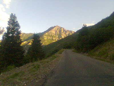
Just as dawn was peeking over the mountains I started my gradual climb through pleasant grove up to the entrance to American Fork canyon. Just before I got to the top of the hill a small group of cyclists pulled out ahead and rode off. I repeated to myself that I was riding my own ride this morning and it wouldn't do any good to blow up before entering the canyon and the big climbing. I stopped at the mouth of the canyon to take a picture of my bike with the national forest sign. While I was stopped a guy on a mountain bike rode by. I caught him pretty quick after I got back on the bike. I commented on the beautiful morning, and he commented on the wind. The wind was indeed howling out the mouth of the canyon but I figured that was just they way canyon mouths were. He said he was from Tempe originally when I mentioned I was from Mesa. He asked if I was going to the top, which of course I was. I pulled away and headed up into the wind.

Road near mouth of canyon

Spires and cliffs above road
 Mountain stream by road.
The grade steps up to 6% pretty quick once you are in the canyon, but to make things more livable, the beautiful trees and swift mountain stream start up. It's wonderful to be breathing heavy and sucking in the fresh air and the smells of the oak trees alongside the creek. Birds are singing in the trees on the side of the road and majestic cliffs tower overhead. Soon I will tower over the cliffs. Up ahead I spot a cyclists who I slowly catch up with. Right as I pass him and exchange a hello I see A great picture of the river and stop. When I start again I catch him fast as he has stopped at a picnic area to turn around.
 Paul is loving life at 6% grade
On up the canyon I move on. I pass Timpanogas cave national monument (not a lot of cave to see from the bike but the scenery is still wonderful). On up the canyon. The creek amazingly enough falls at the same grade the road does and creates a load roaring as the water slams into the rocks in it's rush to reach the mouth of the canyon. I pass small picnic areas nestled into the small spaces between the road and the canyon wall or the river and the canyon wall. Soon I am at the fork in the road where the Alpine Loop goes. From here the road is one lane.

Mountain View
The road climbs up the steep side of the canyon.

The road clings to the hillside

Looking up at Timpanogas

Waterfall on side of road
 Another waterfall on side of road
In here the road ramps up to a constance 8% grade. I keep moving the pedals around and notice I am catching up with one of the guys from the small group I saw earlier. By the second switchback I have nearly caught him but stop to take a picture of Mt. Timpanogas. Around the corner his buddies have been waiting for him and they turn around to head back down. I still have miles more of this before reaching the top.

Paul working hard at 8% grade

Mt. Timpanogas' north peak

The road bikers equivalent to single track.

Aspen Grove a half mile from the top.
 Mt. Timpanogas
The road clings to the cliff face as it rounds bend after bend ever climbing higher into the alpine air and mountains. Now we are looking down at some of the shorter mountains and looking up into the tops of canyons on the side of Timpanogas. Soon we are back by the creek and into the forest but the grade does not let up. Corner after corner we climb through firs and aspen forests. I spot the occasional deer. One even has some antlers growing. I also spot a guy on a horse down in the forest as I get into the last mile of the climb. It's cold in the shadier parts of the climb. My thermometer reads 43 degrees at one point. If it weren't for the fact I was working pretty hard I would be cold.
 Flowers near the summit
Finally I see the top and get there after stopping to take a picture of some of the alpine wildflowers. I stop at the trailhead at the summit to look for a garbage can where I might find a clean garbage bag tucked inside under the bag but there are no garbage cans. I will have to freeze on the coming descent.

The noble steed, with custom taillight (see previous blog entry for details)
 A frosty Paul at the summit
The descent is beautiful and I stop several times on the way down to snap pictures. There are many unsigned hairpin turns and it behooves one to stay at a reasonable speed to avoid shooting off the edge of the road. There are other cyclists climbing up this side and I give each one a nod as they pass. This is a tricky road to descend as it is steep and the turns are sharp so one needs to be careful.
Dropping below majestic canyons and peaks I am rocketing through the lodges of Sundance ski resort (Robert Redford's digs). The road below is shaded and hits 9% as I speed down the road and slowly get colder and colder. A few more switchbacks and I am approaching the junction with Provo canyon where the sun is shining warmly. Provo canyon is warm but due to a 4 lane highway it doesn't quite have the same atmosphere and panache of the loop road that towers above it.
 Mountains above the south side of the loop
All too soon I am back in Provo getting stopped by traffic lights and navigating through traffic. I pass a commuter who does an amazing job of keeping up. I think she has one of those electric bikes, then again, she just could be really fit and waiting for unsuspecting roadie snobs like me to intimidate with her ability to keep up on a frumpy commuting bike designed for short little jaunts. I eventually drop her after an embarrasing moment when I got in the wrong left turn lane not realizing both lanes turned left (fortunately they let me through). Soon afterward I am climbing the hill back up to my sisters house. It is now 71 degrees, a much different temperature than when I left this morning or even than I was riding through an hour ago.
 Mountains above Sundance Ski Resort
In the end I climbed 4000 feet rode 65 miles in 4 hours and 35 minutes for an average speed of 14.4 mph. I won't brag that it is an awesome time, but I will say I am happy with it. I stayed strong throughout the ride and I was not expecting that since I pushed so hard on Saturday. I guess my eat anything that looks like food strategy on Sunday worked for recovery.

Tunnels in Provo canyon
No comments:
Post a Comment