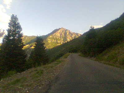
Thursday, July 16, 2009

Don't Let the Sun Go Down On Me....


All dressed out and ready to go.
I had to work late and at 6:45 I realized if I had 19 miles to ride home and if I didn't get to the parking lot before 8 pm I would be riding in the dark without lights. So, despite my near record time this morning and the legs I had run until they were dead this morning still recovering, I would need to make it back to the car in under an hour. A tall order for 19 miles with several hills adding up to over 350 feet of climbing. So, with my buff soaked and put under my helmet, a bit of water on the front of my jersey, and a waterbottle that was frozen solid I was off into the 100 degree heat to sweat myself back to the car in near record time.

A Monsoon storm brewing behind Squaw peak and the Phoenix Mountains
Turning onto the dreamy draw a large man in a hawaiian shirt is shouting F bombs at a lady in a car. He is really in a rage so I stop and stare. I don't do this out of curiosity. I don't want to get involved. I just want to show this big baby he is being watched so he doesn't do anything stupid. I hold my cell phone as he shouts something stupid about her leaving something on the printer. I think how terrible it is that people have to work for some idiot like this and wonder why don't they quit instead of letting this moron fire them. Then I think back to a boss like this I had awhile back. He finishes and storms off. She appears to be very upset. I hope she realizes that she is better off. Hopefully she finds a new job soon. It's funny how silly people look when they try to look tough by letting f-bombs fly. One or two make you look really mad. When you start getting into dozens a minute you are just silly and it loses it's effect I am afraid.

C
The clouds are beautiful though and I am soon climbing up past the Phoenix Mtns enjoying the cloud formations hoping one of those cells is raining on my house way out east.


Storm to the north.


My legs are burning as I hurry to beat the sunset. I climb the last hill and am pushing across the top of the hill and speed up to 27mph down the other side and hold it down towards Tempe. At one point a guy on a nice Cervalo time trial bike tucks in behind me. I'm going 25 and breathing hard but he holds on. I don't know if he is just cooling down or if he is enjoying the pull but he stays on for a few miles before pealing off just before the hill down onto Curry road next to Papago park wishing me good luck as he turns west. I check me computer and notice I have averaged 19.4 mph to this point. I have hopes of hitting a 20 mph average before the park and ride. I am hurting a bit but I still hold it above 20 heading back into Tempe. By the time I reach the park and ride I am at 19.7 mph and at 57 minutes and change. Not 20 but it's still a good time.


I'm not as bad off as I look. Just concentrating as I take the picture.


Back at the car.

Tuesday, July 14, 2009

Mmmmm tastes salty....Ewwwww.....

Well. I couldn't put it off any further. And frankly, I don't think it would have been wise for me to put it off another day. I commuted all the way in today. I didn't get a whole lot of riding in last week after we got back from Utah and by Monday morning I had been in a pretty strong depression for several days. Bicycling nearly everyday has allowed me to get off my antidepressants and so when I missed several days I think it led to a couple of really crappy days. Yesterday morning I forced myself out for 11 miles. Today I was back at it for real. I've had a bit of what I think is a problem with my sciatic nerve which is a pain in my butt going down the back of my thigh. Cycling seems to help it. I can't figure out what caused the problem, perhaps it was doing back flips into the pool Saturday night. I dared my 6 year old son to do a back flip off the diving board and he didn't jump back far enough and the diving board gave him a rasberry on his chest and chin as he dropped into the water. I felt bad and since I had dared him, I got on the board and executed my first back flip. I guess we both got our war wounds in the end.

Back to today's commute though. I haven't done a full commute in with it this hot yet. Not to mention I pushed it pretty hard today. I am working on developing power in the aero bars. With my increased flexibility from my hamstring stretches I have been doing, I have a much flatter back in the bars these days. It still has a curve towards the back but the front is flat. I used to make a big half circle with my back which led to neck pain and in reality, very little aero benefit. I am much better now. My current challenge is to try and get as much power to the pedals in the bars as I do sitting up. So far I am faster on flats or downhill, but any uphill however slight it is sees me going faster in the upright position.

Today I managed to stay at 23-25 mph most of the way accross Mesa which isn't too bad. It was warm but I was doing ok. Getting into Tempe though I was getting hot. In fact as I got closer to Camelback Mtn. my times dropped and I was losing the battle against the heat since I was working REALLY hard and the terrain tended to the uphill. It was in the lower 90s. Somewhere around Camelback road I started getting sweat in my mouth. My buff (really cool product with many uses, one of which helps wick sweat off your forehead) I was wearing was keeping it out of my eyes but the output of sweat was enormous.

I did manage to push out the last 3 hills but I couldn't have taken much more. Just at the spot I start my cooldown I got a flat, which actually turned into 2 thanks to a pinchflat. I am not looking forward to the ride down to the bus stop this afternoon in 110+ degree heat. I am going to fully dress out for the ride and couldn't care less what all the business types on the express bus think. It will be better than business clothes drenched in sweat and the desert dweller has to dress to the conditions. Now to go put my waterbottle in the freezer.

Monday, July 6, 2009

The best 30 miles of cycling on the planet (in my humble opinion).


The Alpine Loop has to be 30 of the best cycling miles on the planet. Even if you don't like hills the scenery is epic and takes one's mind off the suffering. From my Sister's house you wind up with around 65 miles and 4000 feet of climbing by the time you are done. Most of the climbing is done in one big hill.

Leaving Pleasant Grove and approaching American Fork canyon.

I was out of the house just after 4 am so I could be back by 9. It was a chilly morning but not too bad so I thought I would be OK. The temps leaving town were around 55 degrees. It was a nice ride down through the fields west of Provo. I saw one other rider who promptly dropped me after he got back on his bike after fixing a flat. I let him go as I was likely doing a much longer ride than him, and also on Saturday I did a pretty strenuous ride and I was pushing it to do this ride today 2 days later. The flat faeries paid me a visit right after. I elected to put a new tube in since I was in a hurry to get back before 9. I forgot to pick up my old tube though and felt bad about leaving it on the lawn of the industrial plant whose light I changed the tube under.


Just as dawn was peeking over the mountains I started my gradual climb through pleasant grove up to the entrance to American Fork canyon. Just before I got to the top of the hill a small group of cyclists pulled out ahead and rode off. I repeated to myself that I was riding my own ride this morning and it wouldn't do any good to blow up before entering the canyon and the big climbing. I stopped at the mouth of the canyon to take a picture of my bike with the national forest sign. While I was stopped a guy on a mountain bike rode by. I caught him pretty quick after I got back on the bike. I commented on the beautiful morning, and he commented on the wind. The wind was indeed howling out the mouth of the canyon but I figured that was just they way canyon mouths were. He said he was from Tempe originally when I mentioned I was from Mesa. He asked if I was going to the top, which of course I was. I pulled away and headed up into the wind.
Road near mouth of canyon
Spires and cliffs above road

Mountain stream by road.

The grade steps up to 6% pretty quick once you are in the canyon, but to make things more livable, the beautiful trees and swift mountain stream start up. It's wonderful to be breathing heavy and sucking in the fresh air and the smells of the oak trees alongside the creek. Birds are singing in the trees on the side of the road and majestic cliffs tower overhead. Soon I will tower over the cliffs. Up ahead I spot a cyclists who I slowly catch up with. Right as I pass him and exchange a hello I see A great picture of the river and stop. When I start again I catch him fast as he has stopped at a picnic area to turn around.
Paul is loving life at 6% grade

On up the canyon I move on. I pass Timpanogas cave national monument (not a lot of cave to see from the bike but the scenery is still wonderful). On up the canyon. The creek amazingly enough falls at the same grade the road does and creates a load roaring as the water slams into the rocks in it's rush to reach the mouth of the canyon. I pass small picnic areas nestled into the small spaces between the road and the canyon wall or the river and the canyon wall. Soon I am at the fork in the road where the Alpine Loop goes. From here the road is one lane.
Mountain View
The road climbs up the steep side of the canyon.
The road clings to the hillside
Looking up at Timpanogas
Waterfall on side of road

Another waterfall on side of road

In here the road ramps up to a constance 8% grade. I keep moving the pedals around and notice I am catching up with one of the guys from the small group I saw earlier. By the second switchback I have nearly caught him but stop to take a picture of Mt. Timpanogas. Around the corner his buddies have been waiting for him and they turn around to head back down. I still have miles more of this before reaching the top.
Paul working hard at 8% grade
Mt. Timpanogas' north peak
The road bikers equivalent to single track.
Aspen Grove a half mile from the top.
Mt. Timpanogas

The road clings to the cliff face as it rounds bend after bend ever climbing higher into the alpine air and mountains. Now we are looking down at some of the shorter mountains and looking up into the tops of canyons on the side of Timpanogas. Soon we are back by the creek and into the forest but the grade does not let up. Corner after corner we climb through firs and aspen forests. I spot the occasional deer. One even has some antlers growing. I also spot a guy on a horse down in the forest as I get into the last mile of the climb. It's cold in the shadier parts of the climb. My thermometer reads 43 degrees at one point. If it weren't for the fact I was working pretty hard I would be cold.

Flowers near the summit

Finally I see the top and get there after stopping to take a picture of some of the alpine wildflowers. I stop at the trailhead at the summit to look for a garbage can where I might find a clean garbage bag tucked inside under the bag but there are no garbage cans. I will have to freeze on the coming descent.
The noble steed, with custom taillight (see previous blog entry for details)

A frosty Paul at the summit

The descent is beautiful and I stop several times on the way down to snap pictures. There are many unsigned hairpin turns and it behooves one to stay at a reasonable speed to avoid shooting off the edge of the road. There are other cyclists climbing up this side and I give each one a nod as they pass. This is a tricky road to descend as it is steep and the turns are sharp so one needs to be careful.

Dropping below majestic canyons and peaks I am rocketing through the lodges of Sundance ski resort (Robert Redford's digs). The road below is shaded and hits 9% as I speed down the road and slowly get colder and colder. A few more switchbacks and I am approaching the junction with Provo canyon where the sun is shining warmly. Provo canyon is warm but due to a 4 lane highway it doesn't quite have the same atmosphere and panache of the loop road that towers above it.
Mountains above the south side of the loop

All too soon I am back in Provo getting stopped by traffic lights and navigating through traffic. I pass a commuter who does an amazing job of keeping up. I think she has one of those electric bikes, then again, she just could be really fit and waiting for unsuspecting roadie snobs like me to intimidate with her ability to keep up on a frumpy commuting bike designed for short little jaunts. I eventually drop her after an embarrasing moment when I got in the wrong left turn lane not realizing both lanes turned left (fortunately they let me through). Soon afterward I am climbing the hill back up to my sisters house. It is now 71 degrees, a much different temperature than when I left this morning or even than I was riding through an hour ago.
Mountains above Sundance Ski Resort

In the end I climbed 4000 feet rode 65 miles in 4 hours and 35 minutes for an average speed of 14.4 mph. I won't brag that it is an awesome time, but I will say I am happy with it. I stayed strong throughout the ride and I was not expecting that since I pushed so hard on Saturday. I guess my eat anything that looks like food strategy on Sunday worked for recovery.

Tunnels in Provo canyon

Saturday, July 4, 2009

Epic Climbs of Insomnia

Looking down on Utah valley from high up on the Nebo loop.


What happens when you set your alarm for 3:30 am it's daylight savings time and your biological clock is mixed up from driving all night the day before? You wake up at 12:45 MST/1:45MDT and think you have overslept by 15 minutes. I didn't discover that it wasn't 4 o'clock until I was down the road aways. Getting out this early did mean I would be able to do the whole ride I had intended this morning. I had to be back by 10 so I thought I was going to have to settle for an 80 mile ride instead of the 100 mile ride I had intended.


So, 2 AM, after I have told my son to go back to bed again, I was out pumping up my tires, adjusting the headlight and then came the time to turn the taillight on. Hmmm, it seemed something was missing. Yes, I had forgotten my taillight. I had my ankle reflectors, my sam brown belt, and my spare headlight but no taillight. This was a bit of a deal breaker when you are going to be riding for 3 or 4 hours in the dark. The thought occured to me that I could hang the spare headlight off my seatbag and set it on flash, of course, it is technically illegal to have a flashing white light on the back so I searched the back of the van desperately for something red I could put over the light. I found a Lightning McQueen water bottle that one of my kids had brought. So I stuffed the throat of the bottle over the top of the headlight and put it on the seatbag. It was a little funny looking but it worked.


I was off into the night. A few miles down the road I would start to get preoccupied with the fact I had forgotten a windbreaker. Temps were in the upper 50's and I wasn't too cold now. I knew that as I climbed up the mountain it would get colder. My other concern was thunderstorms. It had rained at my sister's house overnight and I was worried I would find more weather as I went on. Fortunately I didn't run into any rain, just wet roads.

I was a little disappointed in my speed heading down to Salem but my legs didn't feel bad so I chalked it up to headwinds and climbing. I kept a vigilant eye open for a gas station where I could top off my bottles before the big climb. One thing about little Utah towns, they completely shut down at night. I was at the edge of town when I realized I was going to have to get creative as I headed up the road to enter Payson Canyon. I had inspiration as I passed the last set of houses before heading into the canyon. It occured to me that every one of these houses probably had a garden hose. I was careful to choose a house with a for sale sign as the house was probably vacant. I managed to top off without any uncomfortable confrontations with gun wielding homeowners.


So, without further ado, I was off into the night with the red flashing waterbottle hanging off my saddle looking like a crazy chinese lantern. Entering the canyon I would surprise many deer. I would actually get within 10 feet of one before he realized I was a person and ran off. I also startled a bunch of fawns, and may have seen a lynx but it ran off before I could be sure. The road in the lower canyon goes along the side of a creek with green trees and the occasional house is still on the side of the road but soon I am stopping at the first parking area looking for a garbage bag I could possibly use as a wind break for the descent later. Unfortunately the bathrooms were locked.

After the simple 2-3% grades of the first few miles the climb ramps up to the 6-9% grades that will be a constant over the next 15 miles. Not too long after the initial climbing I found some open restrooms but they didn't have garbage cans. So back onto the road I went again. I was getting into the groove now. Occasionally I would stand and pedal for awhile to rest the back and use some different muscles. Even so this climb takes everything you got. Last year it took me almost 4 hours to climb this hill. In some respects the hill went faster than last year climbing it in the dark. First comes the 7000 foot sign signifying you have climbed 2400' since the bottom of the hill. It's an important milestone that lets you know that though your legs have been burning for the last hour + you actually have something to show for it at this point. The flip side is it gets you looking for the 8000' sign which now seems to take forever to come up.


As you approach the 8000' sign you start to find the switchbacks are ending and the terrain is starting to mello out enough to allow places to camp. Between here and the other end of the loop I must have seen 10-20 family reunions out camping in the greeen meadows off the side of the road as I climbed further up. The hill changes past the 8000' foot mark. The quad crushing spirit damping constant leg burn gives way to short flat stretches between steep hills as you stair step up to 9000'. Most of the hills are 9-11% grades. So although you get to rest a little in between you are working harder when you climb. Even so I found the compact crankset was doing pretty good. I had a lot more energy at this point then I did last year. Amazingly enough I was able to keep enough juice coming out of the generator to keep the light on. When i stood up the light would pulse as I shifted from foot to foot.

Around this time the first hint of dawn was coming and the mountain birds started singing. I recognized many of the calls to birds that would sing outside my window in the mornings when I was growing up in Flagstaff. The Aspen and fir trees actually took more form, and the green meadows and forests started to appear out of the darkness as I climbed. Not a soul was stirring in the campsites at the side of the road. Occasionally I would see a light in the camp as I passed but not a soul. I had only heard one car pass while I was in the restroom further down but besides that I had not seen a single car. I had started the hill down in the cottonwoods and sage and had climbed up through fir forests and now I was entering the aspens. I had stopped seeing deer, perhaps that was a result of seeing more campers, or perhaps there just wasn't as much grazing area up here.

The final 7 miles or so of the hill walk up a ridge going over and around knobs. I was hoping I would get up onto this section before sunrise as it is this part of the road where you start looking down at the other mountains around and you get a clear view of the sky to the east. I made it actually and as I rode eastward towards the mountain I would watch the sunrise unfold behind me in my mirror and when I would stop occasionally to take pictures.

I was amazed at how much more energy I had up here. I was in a lot better shape this year. I also looked at my watch and noticed I might be able to get to the top in 3 hours which would be about an hour faster than last year. There are six false summits on this climb which can really mess with your psyche. I find it is easier if you know they are there. This year the climbs up over the nobs did not seem nearly so big. I still had good power and the beautiful mountain morning was invigorating. It was about 47 degrees up on the mountain and I was in shorts and a jersey. It ended up working but I think a windbreaker still would have been handy.

Approaching Nebo

Around another corner and I saw Mt. Nebo lit up in the rays of the morning sun and stopped for a picture. Around here I would start to see occasional cars, but I only saw 3 or 4 before I was down the other side of the mountain. In 2 more nobs I was at the road's summit. 9345 feet, I hadn't really noticed the altitude as much this year. Probably because I am in better shape. Anyway, it was 6:30 am and I had climbed the hill in 3 hours. I still felt pretty strong too. Being this early it also meant I could go forward with the original plan of dropping down the other side of the mountain to the town of Nephi and head home from there to make a hundred miles exactly.
Mt. Nebo from east


I had to make one more rest stop before dropping down and was dismayed to find no garbage cans with a bag I could use. So I steeled myself for a long cold descent. I stopped at the last mountain overlook to take a picture next to a guy looking at the mountain through a spotting scope, then I was off. I stopped once to put my energy mix into my remaining waterbottle so I would have something to burn to keep me warm on the way down. I'm experimenting with putting soy protein in my maltodextrin and it seemed to work pretty good.

Nebo from southwest

It was a bit of a treacherous descent. Around many of the corners there were rocks that had rolled out into the road from the rainstorms that night. I was getting spray kicked up onto me from the road and that was pretty cold. I had to ride my brakes pretty hard as it was a steep twisty descent and if you go too fast the mistake could be disasterous. I stopped momentarily to look at the devil's kitchen but I think it was a little overrated, of course I am probably a bit jaded since the great red rocks of Sedona are in my neck of the woods, and this didn't compare to much to those.

Nebo south face

At one point the road was cut to one lane as the other lane had slid down the hillside in a landslide. Occasionally there were bands of dirt across the road where they had dug something up and it made for a bit of white knuckle fun when you hit them at 30 hoping your wheels wouldn't slip. There was a wet cattle guard too that gave me a bit of a tense moment. I did make it through the steep stretch safely though.


The south side of the loop is a lot less green and what trees there are, are just blackened trunks remaining from a fire. The geology is more of a clay/Shale type of rock. The road was a lot straighter though so I was able to build up some speed and shoot on down to the highway where it was 4 miles to Nephi.

The devil's kitchen

The Utah valley has a whole handful of little farming communities spread out across the flats. The first of these I would get to was Nephi. Just about every one of these towns takes it's name from the Bible or the Book of Mormon. This was one of those from the latter. If you ever want to wander into a little town similar to what you might find in 'The Music Man'. Theres a main street with an old firehouse, an aging used car dealership. Today there was a rip roaring community carnival getting put together in the town park. All the streets are lined with small brick houses with large trees out front. Fortunately I did not encounter any of the dogs that usually wander this type of town. Opie Taylor could be lurking anywere.
Downtown Nephi

Leaving Nephi I am out into the farmland mostly flat with the occasional gentle hill to break the monotony. There are green fields with occasional farms and silos. I am keeping my speeds above 20 most of the way across the valley floor. To my right are the mountains I just went over. After I pass through another small farm town called Mona I catch glimpses of the peaks of Mt. Nebo. I am still strong and I think I might have enough drink left in the bottle to get me back to my Sister's house. In Santaquin I guess that Main street is the street I should turn on since they have not signed the highway numbers. I guessed right fortunately.
Flat Country
More Farms
Toto, something tells me we aren't in the mountains anymore.
Silos and Mt. Nebo from the West
A Lavender Farm

It is a quick drop down into Payson from there and it would take me less than an hour to get back to Springville. The temperatures were still in the 70's when I got back and they were eating breakfast. Mmmmmm, pancakes.
Sister's home sweet Sister's home.

So to sum up, I took an hour off my time to climb the hill, rode 100 miles, and had over 6000' of climbing. Not too bad. Now to eat like no tomorrow so I'll be ready for Monday morning when I plan on doing the alpine loop.

Spanish Fork Reservoir from up at play area

Thursday, July 2, 2009

The hardest part of training...

Well, I tried to do an interval workout on the way into work yesterday but my legs just wouldn't get the oomph back into them. Though my heartrate was at record lows (45 bpm) this morning I think I am a bit overtrained, or calorie deficient. I hopped the light rail to get to work so I could cut a few miles off and was dismayed to find I could have probably ridden faster in. Oh well. I need to get the legs juiced back up before Saturday as the climb up Nebo is seriously intense and long. I'm taking a few days off and eating like a pig. I think the problem is I have been shorting myself on too many calories, especially last week with the extra mileage I did. So today I am taking it easy and going to pack the new steed into the back of our van amid the luggage (carefully of course) and drive to a land of epic climbs and flat farmlands. Utah is really quite a land of contrasts. On one side you have all the 1950s apple pie Donna Reed, Richy Cunningham, Opie Taylor Mormons and on the other you have the Ski towns on the opposite end of the spectrum with the night life and beer commercial backdrops. From a cyclist's perspective there is the flat rides of the farms and valleys, and yet, a few miles to the east you can be sweating at 10%+ in steep canyons climbing the Wasatch front range in aspen and fir forests amidst high mountains with patches of snow on them into July. There are 2 epic climbing routes within 20 miles of my Sister's house. One is the Mount Nebo Loop which by the time I ride to it, over, and then back through Nephi I will have as much time riding on flats as I will climbing the 5000' foot hill, it should be about 100 miles and 6000 feet of climbing, almost all of it in the one hill. The other epic ride is the Alpine Loop. It's not as much climbing but the scenery is epic. It goes through Timpanogos cave national monument on one side, and down through Sundance Ski area on the other. You circle Mt. Timpanogos in the process. The climbs though not as tall are steep and the air is thin. I hope I am recovered. I am eager to see how I handle the climbs with the new compact crankset. We'll see. Now to rest, the hardest part of training.